 vesseltracker.com
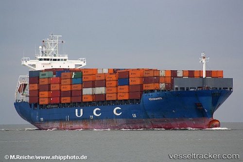
Vessel MSC Chulai III IMO: 9305013, MMSI: 371543000 Container Ship
UTC, -34.24947, 171.36320, course: 73, speed: 10.9
UTC, -34.06444, 171.92052, course: 79, speed: 11.6
2026-01-29 11:58:57 UTC, -33.93426, 172.27592, course: 73, speed: 12
Live AIS position:
UTC. 98 nm NW of Whangaroa),
updated 2026-01-29 11:58:57 UTC.
Find the position of the vessel MSC Chulai III on the map. The latter are known coordinates and path.
marine traffic ship tracker show on live map
The current position of vessel MSC Chulai III is -33.93426 lat / 172.27592 lng. Updated: 2026-01-29 11:58:57 UTCCurrently sailing under the flag of Panama
Details:
Last coordinates of the vessel:
UTC, -34.37688, 170.99548, course: 69, speed: 10.3UTC, -34.24947, 171.36320, course: 73, speed: 10.9
UTC, -34.06444, 171.92052, course: 79, speed: 11.6
2026-01-29 11:58:57 UTC, -33.93426, 172.27592, course: 73, speed: 12